
Fájl:Map of Indonesia relief location.png
Nem érhető el nagyobb felbontású változat.
Map_of_Indonesia_relief_location.png (800 × 307 képpont, fájlméret: 451 KB, MIME-típus: image/png)
| Leírás |
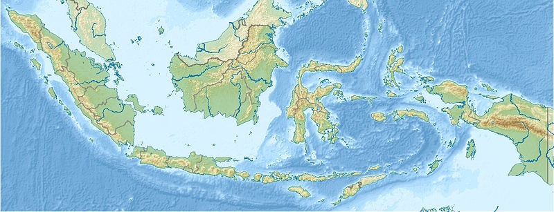
English: PNG version of File:Indonesia_relief_location_map.jpg
Equirectangular projection. Strechted by 100.0%. Geographic limits of the map: N: 6.5° N W: 94.5° E E: 141.5° E Made with Natural Earth. Free vector and raster map data @ naturalearthdata.com. S: -11.5° N |
| Dátum | |
| Forrás | http://en.wikipedia.org/wiki/File:Indonesia_relief_location_map.jpg |
| Szerző | User:Uwe Dedering |
| Engedély (Fájl újrafelhasználása) |
"You are free: to share – to copy, distribute and transmit the work to remix – to adapt the work Under the following conditions: attribution – You must attribute the work in the manner specified by the author or licensor (but not in any way that suggests that they endorse you or your use of the work). share alike – If you alter, transform, or build upon this work, you may distribute the resulting work only under the same or similar license to this one." |
Ez a fájl a Creative Commons Nevezd meg! – Így add tovább! 1.0 Általános licenc alapján használható fel.
- A következőket teheted a művel:
- megoszthatod – szabadon másolhatod, terjesztheted, bemutathatod és előadhatod a művet
- feldolgozhatod – származékos műveket hozhatsz létre
- Az alábbi feltételekkel:
- Nevezd meg! – A szerzőt megfelelően fel kell tüntetned, hivatkozást kell létrehoznod a licencre és jelezned kell, ha a művön változtatást hajtottál végre. Ezt bármilyen észszerű módon megteheted, kivéve oly módon, ami azt sugallná hogy a jogosult támogat téged vagy a felhasználásod körülményeit.
- Így add tovább! – If you alter, transform, or build upon this work, you must distribute the resulting work under the same license as the original.
Fájltörténet
Kattints egy időpontra, hogy a fájl akkori állapotát láthasd.
| Dátum/idő | Bélyegkép | Felbontás | Feltöltő | Megjegyzés | |
|---|---|---|---|---|---|
| aktuális | 2013. augusztus 4., 11:08 | 800 × 307 (451 KB) | Hz.tiang | {{subst:Upload marker added by en.wp UW}} {{Information |Description = {{en|PNG version of File:Indonesia_relief_location_map.jpg Equirectangular projection. Strechted by 100.0%. Geographic limits of the map: N: 6.5° N W: 94.5° E E: 141.5° E Made ... |
Fájlhasználat
Az alábbi lapok használják ezt a fájlt:
Globális fájlhasználat
A következő wikik használják ezt a fájlt:
- Használata itt: hu.wikipedia.org
- Használata itt: km.wikipedia.org